
by John H. Sandy
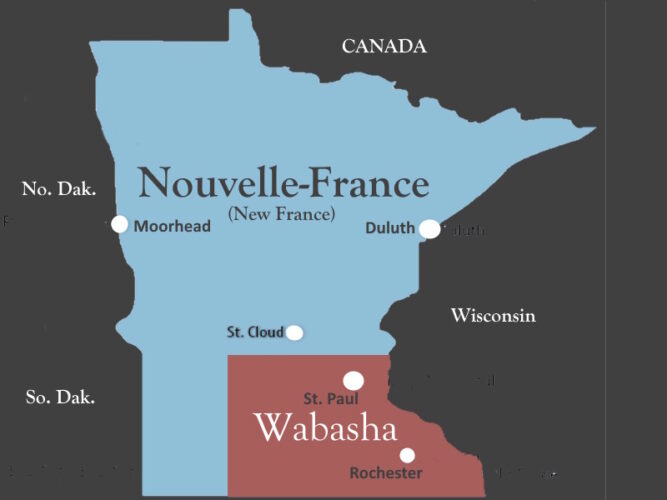
Map of Nouvelle-France (New France) and Wabasha regions and counties within each region.
Broader outline shows boundaries of the state of Minnesota and
bordering states and Canada.
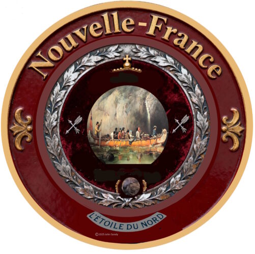
Nouvelle-FRANCE
(New France)
L’Étoile du Nord
Nouvelle-France is a geographic region with an economic system based on farming, mining, tourism, and small businesses. Prairies, forests, lakes, and wilderness give the region its special character. Nouvelle-France is a vast domain in north-central United States, bordering Canada. The motto L’Étoile du Nord (Star of the North) captures the essence of this region.
The phrase L’Étoile du Nord had its origin in France when a French opera with the name “L’Étoile du Nord” opened in Paris in 1854. Later, in 1856, “L’Étoile du Nord” was performed in New York City. And in 1861, the state of Minnesota adopted the phrase as its official motto. When viewed in this context, the state’s motto was likely borrowed from others, not an original phrase coined by officials in Minnesota.
Explorers from France were the first Europeans to arrive in the upper Mississippi region that later became Minnesota. Before the French, this area of North America was inhabited by Ojibwe and Dakota Indians.
From 1682 and for more than 120 years, the Upper Mississippi region was claimed by France. The region was called Nouvelle-France (New France). As early as 1659, Medard Chouart des Groseilliers and Pierre Esprit Radisson scouted the wilderness at the tip of Lake Superior, where modern-day Duluth is located. As interest in the region grew, other French explorers followed. In 1673, Louis Joliet and Father Jacques Marquette traveled on parts of the Mississippi. In 1678, historians say that Daniel Greysolon, Sieur du Lhut, was at Mille Lacs. Most famous was Joseph Nicollet, who created detailed maps of the region.
Following the French and Indian War, 1754-1763, France lost the Northwest Territory, including land east of the Mississippi, which later became a part of Minnesota, to Great Britan. Subsequently, in 1783, the Northwest Territory was ceded to the United States, after the U.S. won its independence from Great Britian. And in 1803, France sold Louisiana, which included lands west of the Mississippi in current Minnesota, to the United States.
The fur trade was the economic engine of the region from the mid-1600s to the mid-1800s. French-Canadians voyageurs traded with Native Americans for valuable furs, giving the Indians manufactured goods from Europe in return.
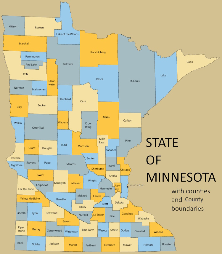
Duluth is the largest city and the cultural and economic hub of Nouvelle-France. Other large cities include St. Cloud, Moorhead, Marshall, Bemidji, Fergus Falls, Alexandria, and Brainerd. The region of Nouvelle-France has 49 counties. Population of the Nouvelle-France region, 1,310,000 (Est.). Culturally, Nouvelle-France aligns with European ancestry.
Nouvelle-France is a region with many common interests. Efforts to promote and advance the economy and culture, and enhance the natural environment, of the rural areas and small and medium-sized communities in the western and northern parts of the state of Minnesota can foster progress and well-being of all who live in the region.
Flag for Region of Nouvelle-France (New France)

Seal for Region of Nouvelle-France (New France)
WABASHA
Mni Sóta Makoce
Wabasha, the other geographic region on this map, is dominated by an urban population living in the Twin Cities (Minneapolis and St. Paul) and its suburbs. Rochester is another large city in Wabasha.
The region of Wabasha has 35 counties. Population of the Wabasha region is 4,397,000 (Est.). Ancestry of the region is mainly European (Scandinavian and German), but large pockets of people from Africa, Asia, and other areas around the world live in Wabasha’s larger cities.
Before European settlement began, this region was inhabited by Dakota Sioux Indians. Mni Sota Makoce is interpreted from the Dakota language as “land where the waters reflect the clouds.”
Flag for Region of Wabasha

Seal for region of Wabasha

![]()
The State of Minnesota, the political umbrella for both regions, has recently redesigned its state seal and flag.
![]()
Note: The map of regions at the top of this page above merges Jackson with Nobles County, Murray with Cottonwood County, and Lyon with Redwood County.
FOR REFERENCE:
A short history of New France: ReadEpub
January 2025
